For several years now, in modern agriculture, various innovative technologies have been used to automate work processes that were previously managed manually. Automatic steering tractors, intelligent seeding systems, and software for agronomic management are just examples of smart applications for sustainable and precision agriculture.
Even artificial intelligence, particularly computer vision, plays a fundamental role in the concept of Agriculture 4.0. Analysis of aerial images acquired through drones is an excellent tool to understand various types of issues, allowing for rapid strategic interventions in the area with significant advantages in terms of both costs and environmental sustainability.
For these types of analyses, various techniques and a multitude of video sensors can be used. The most commonly used video sensors are certainly multispectral cameras, used in agronomy for creating vigor maps and recognizing water stress or specific diseases.
In detail, multispectral cameras are characterized by capturing images with a number of electromagnetic bands generally ranging from 3 to 10. The most common ones, color cameras, capture the three visible spectrum bands corresponding to the colors red, green, and blue, in addition to the near-infrared (NIR) band. The values captured are then evaluated using the NDVI (Normalized Difference Vegetation Index), an excellent indicator to analyze the well-being of various crops such as vineyards or general farmland.
As easily understood from the graph in the following figure, high reflectance in the near-infrared band indicates a healthier state of the crop, while combinations of different wavelengths allow identifying potential anomalies such as differences in growth or emerging issues within the plot.
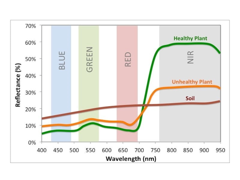
NDVI Index (image source: https://physicsopenlab.org/)
All these assessments also aim to generate prescription maps for variable-rate application of fertilizers, save agronomic inputs through variable and targeted use in the plot, and reduce environmental impact on the soil.
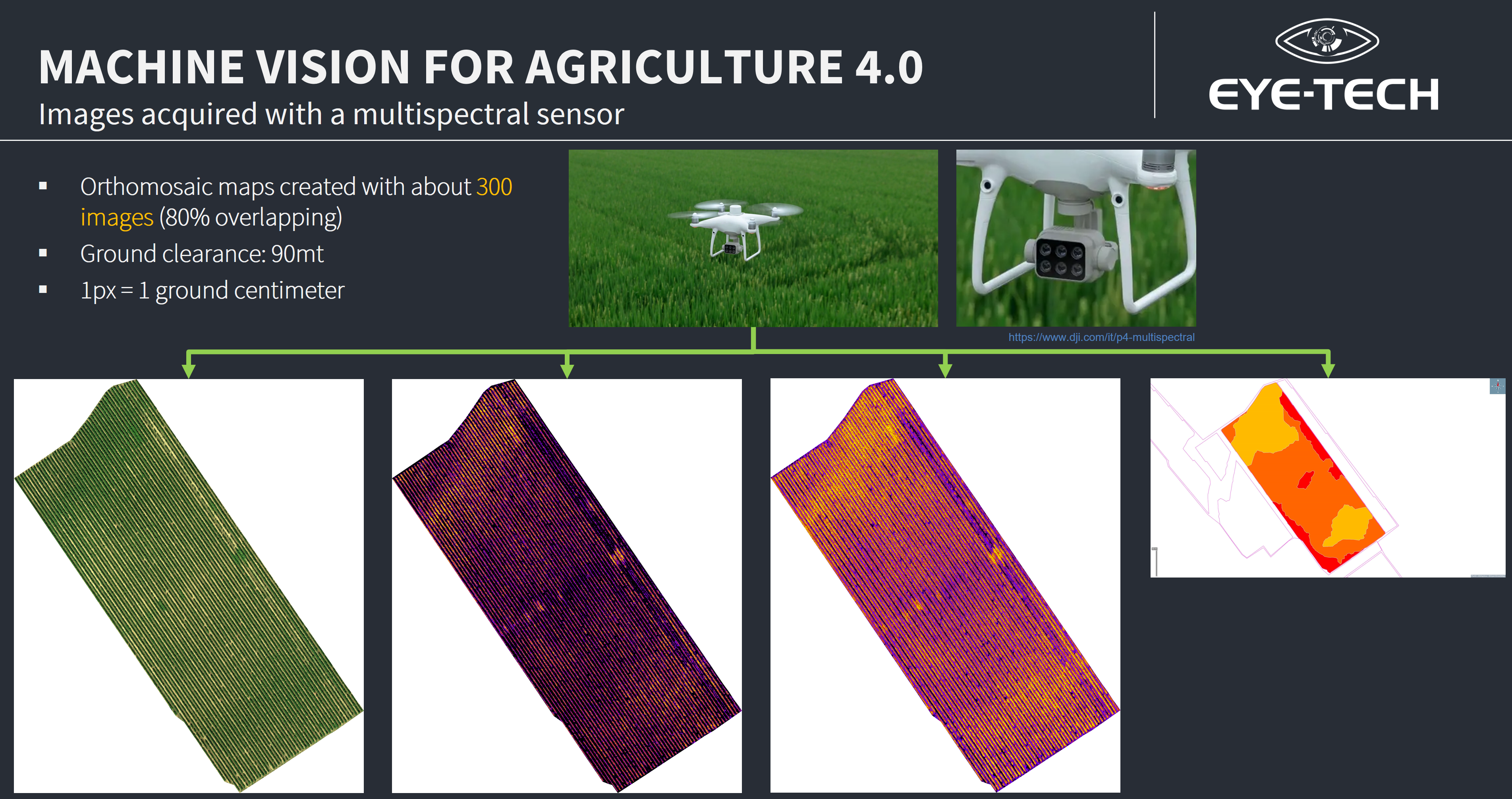
Example of aerial shots using a multispectral camera mounted on a drone
 In this context, Eye-Tech, in collaboration with AgriObiettivo, a company in Pordenone specializing in cultivation management and analysis through drone-based surveys, offers a consulting service in the automatic processing of images taken by drones, allowing, thanks to the use of artificial intelligence, evaluations of even very large areas where quick maintenance interventions are needed to address critical issues difficult to detect with simple manual checks.

Use of artificial intelligence to identify issues in the analyzed area, such as gaps, water stress, etc.
If you are interested in these types of services, contact us now! Our staff can respond to all your requests without obligation.
Sources for images:
- https://www.dji.com/it/p4-multispectral
- https://physicsopenlab.org/